Lodging nearby BEST INN MOTEL
Rwanda
Lodging nearby BEST INN MOTEL
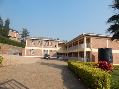
BEST INN MOTEL
KK50ST, Kigali, Ruanda
contacts phone
:
+250 788 345 686
Latitude:
-1.97372
, Longitude:
30.11539
larger map & directions
read more
nearest Lodging
182 m
Centre d'Acceuil Bonne Espérance
KK 331 Street, Kigali
Lodging
read more
270 m
Shammah Guest House
ADEPR Kicukiro
Lodging
read more
305 m
Eden Escape Apartments
KG 601 St, house number 31, Gishushu, Kigali
Lodging
read more
364 m
Peaceful Home Away From Home
KK 329 St, Niboye
Lodging
read more
740 m
AEE
Kigali
Lodging
read more
755 m
Modern Villa Hotel
KK 232 Street, Kigali
Lodging
read more
973 m
Rainbow Hotel
KK 341 Street, Kigali
Lodging
read more
1.196 km
Yerbis Guest House
KK 19 Avenue, Kigali
Lodging
read more
1.379 km
Sarangbang Lodge
Kigali
Lodging
read more
1.471 km
Grand Legacy Hotel
KN 3 Road, Kigali
Lodging
read more
1.501 km
Hotel Hilltop and Country Club
Kigali International Airport Rd, Kigali
Lodging
read more
1.557 km
CityBlue Hotel & Suites
Boulevard de l'Umuganda, Kigali
Lodging
read more
1.607 km
Airport Link Hotel Kigali
Rukiri II
Lodging
read more
1.616 km
Civitas Hotel
KG 1 Avenue, Kigali
Lodging
read more
1.666 km
Zamisol Tourist Inn
Rukiri II
Lodging
read more
1.669 km
Elite Motel
KG 113 Street, Kigali
Lodging
read more
1.692 km
Amahoro Smart Motel
KG 113 Street, Kigali
Lodging
read more
1.705 km
Dorado Cornerstone Motel
KK 3 Avenue, Kigali
Lodging
read more
1.706 km
Traveller's Rest
KG 113 Street, Gasabo
Lodging
read more
1.755 km
Michael's Den Hotel
KG 11 Avenue, Kigali
Lodging
read more
1.816 km
Alink Hotel
7, KG 626 Street, Kigali
Lodging
read more
1.827 km
One Hill Motel
KG 626 Street, Kigali
Lodging
read more
1.929 km
Champion Hotel
Kigali
Lodging
read more
2.004 km
Tavola Guest
231st kacyiru road 50k, Kigali
Lodging
read more
2.625 km
Cari Hotel
KG 6 Avenue, Kigali
Lodging
read more
📑
all categories
Accounting
Administrative area level 1
Administrative area level 2
Airport
Amusement park
Art gallery
Atm
Bakery
Bank
Bar
Beauty salon
Bicycle store
Book store
Bowling alley
Bus station
Cafe
Campground
Car dealer
Car rental
Car repair
Car wash
Casino
Cemetery
Church
City hall
Clothing store
Colloquial area
Convenience store
Country
Courthouse
Dentist
Doctor
Electronics store
Embassy
Finance
Florist
Food
Furniture store
Gas station
General contractor
Grocery or supermarket
Gym
Hair care
Hardware store
Health
Hindu Temple
Home goods store
Hospital
Insurance agency
Jewelry store
Laundry
Lawyer
Library
Liquor store
Local government office
Locality
Lodging
Meal takeaway
Mosque
Movie theater
Moving company
Museum
Natural feature
Neighborhood
Night club
Painter
Park
Parking
Pet store
Pharmacy
Place of worship
Plumber
Point of interest
Police
Post office
Premise
Real estate agency
Restaurant
Route
School
Shoe store
Shopping mall
Spa
Stadium
Storage
Store
Supermarket
Taxi stand
Transit station
Travel agency
University
Veterinary care
sublocality level 1
↑